The annual Excellent Adventure has come to a close for 2015 and this year, the four of us (myself, my friends Tom Green and Doug Winnie and my son Joseph Hutt) went where none of us had gone before; the Rock. It was a great week. We saw many amazing things in Gros Morne National Park and Woody Point where we stayed, and got a good dose of culture and history in St John's (All four of us became Honorary Newfoundlanders at a Screech-In on George Street in St. John's).
I have culled nearly 560 photos down to about 160. That series went on Flickr last night. This series is culled further, but it's still large enough that I've decided to break it up into parts (a technique I'm stealing from fellow Behancer - David Martin.
Part 1 was the beginning of the adventure, so you will see photos from Pouch Cove.
Part 2 includes photos from Witless Bay, Colony of Avalon.
Part 3 covers St John's, Cape Spear and Signal Hill.
Part 4 shows off Woody Point (our main base of operations in Gros Morne).
Part 2 includes photos from Witless Bay, Colony of Avalon.
Part 3 covers St John's, Cape Spear and Signal Hill.
Part 4 shows off Woody Point (our main base of operations in Gros Morne).
Part 5 encompasses the Hike from Hell.
Part 6 focuses on a much nicer hike to Western Brook Pond.
On a Personal Note...
This project is the last in a series of six projects I've put together, documenting the latest Excellent Adventure. A trip shared by me, my long time good friend Tom Green, my son, Joe Hutt and my other dear friend, Doug Winnie, this has been an on-going tradition for us for the past 9 years. And it truly has been excellent, every single time. In past trips, Tom's son Rob has joined us as well as other friends such as Michael Clawson.
This trip blends mild adventure (or perhaps misadventure is a better word), ridiculous amounts of fun and laughter, with a good helping of camaraderie and self reflection. In short, an opportunity to disconnect (well, sort of), to decompress and to recharge. By the end of the trip, we are all the better for having been there.
I would not miss this trip for the world. I can't wait for next year.
Final Day
Our last day in the park started off overcast, and would end with more rain, but that did not deter us from making a start on a series of excursions that would begin with (and, sadly, end with), a trip to Western Brook Pond.
View from the Other Side
On route to Western Brook Pond, we had to drive around Bonne Bay and found ourselves in Norris Point, directly across the bay from Woody Point. We stopped at the visitors centre for a few minutes and I made a few images of Woody Point, to put the village in context.
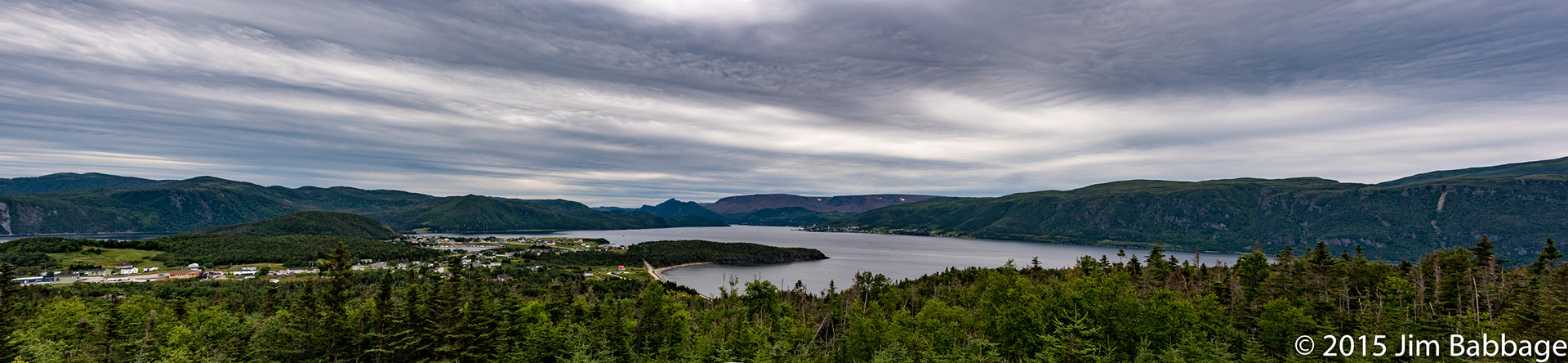
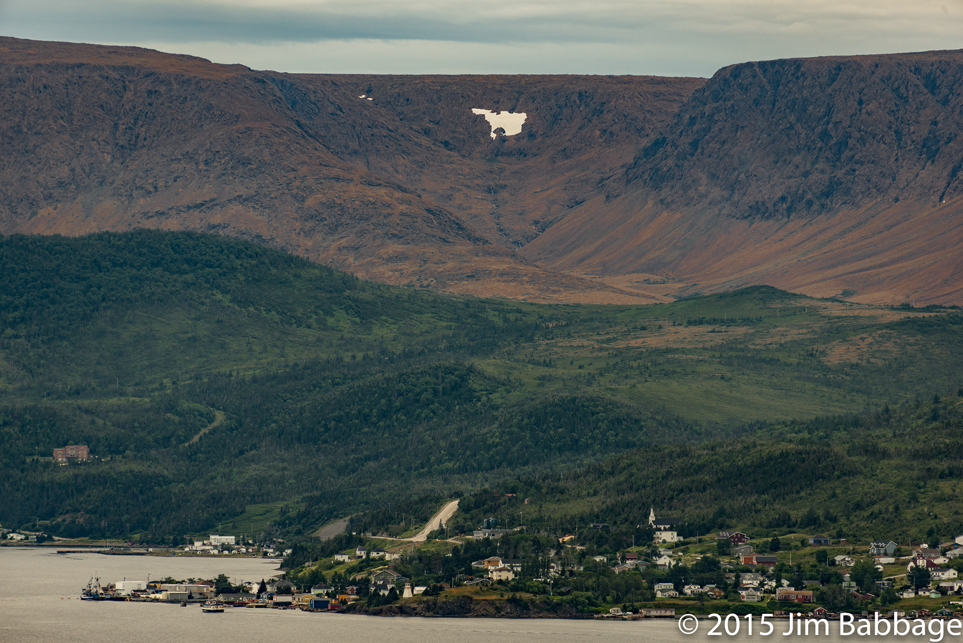
Woody Point, dwarfed by the Tablelands in the background. Close to bottom-centre, you can see the lighthouse that dominated my Part 4 project. Shot with my 28-300mm Nikkor, this image was a tough one to process in Lightroom, without making the scene appear unnatural. Too much Dehaze turn all thre greenery blue and really messed up the colour of Tablelands. There was a fair amount of local colour adjustment needed in this image.
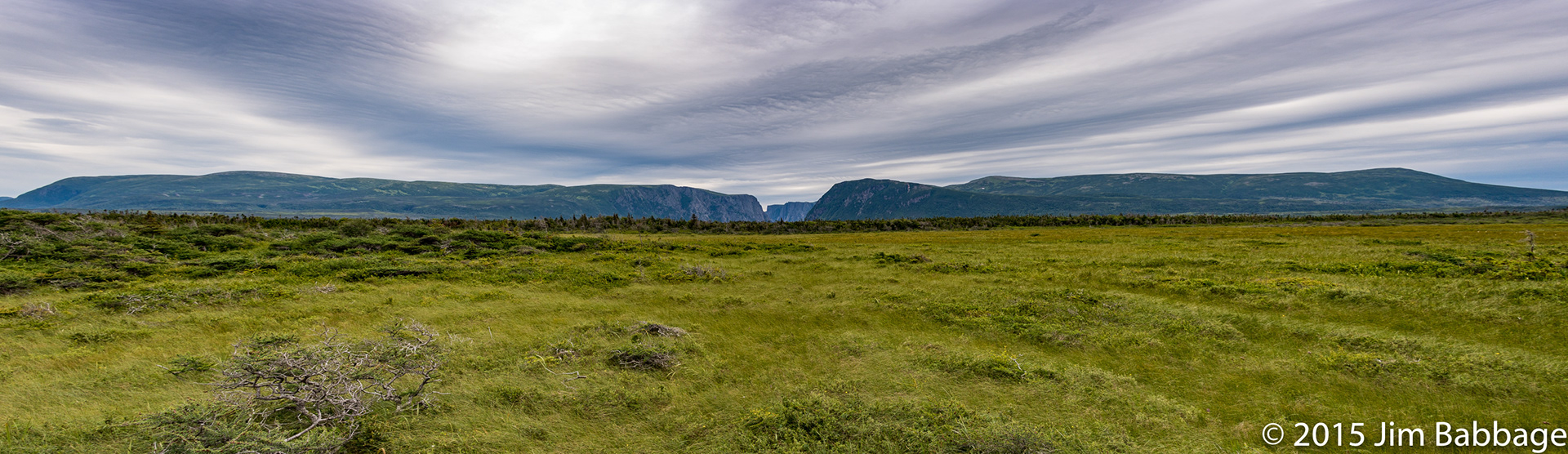
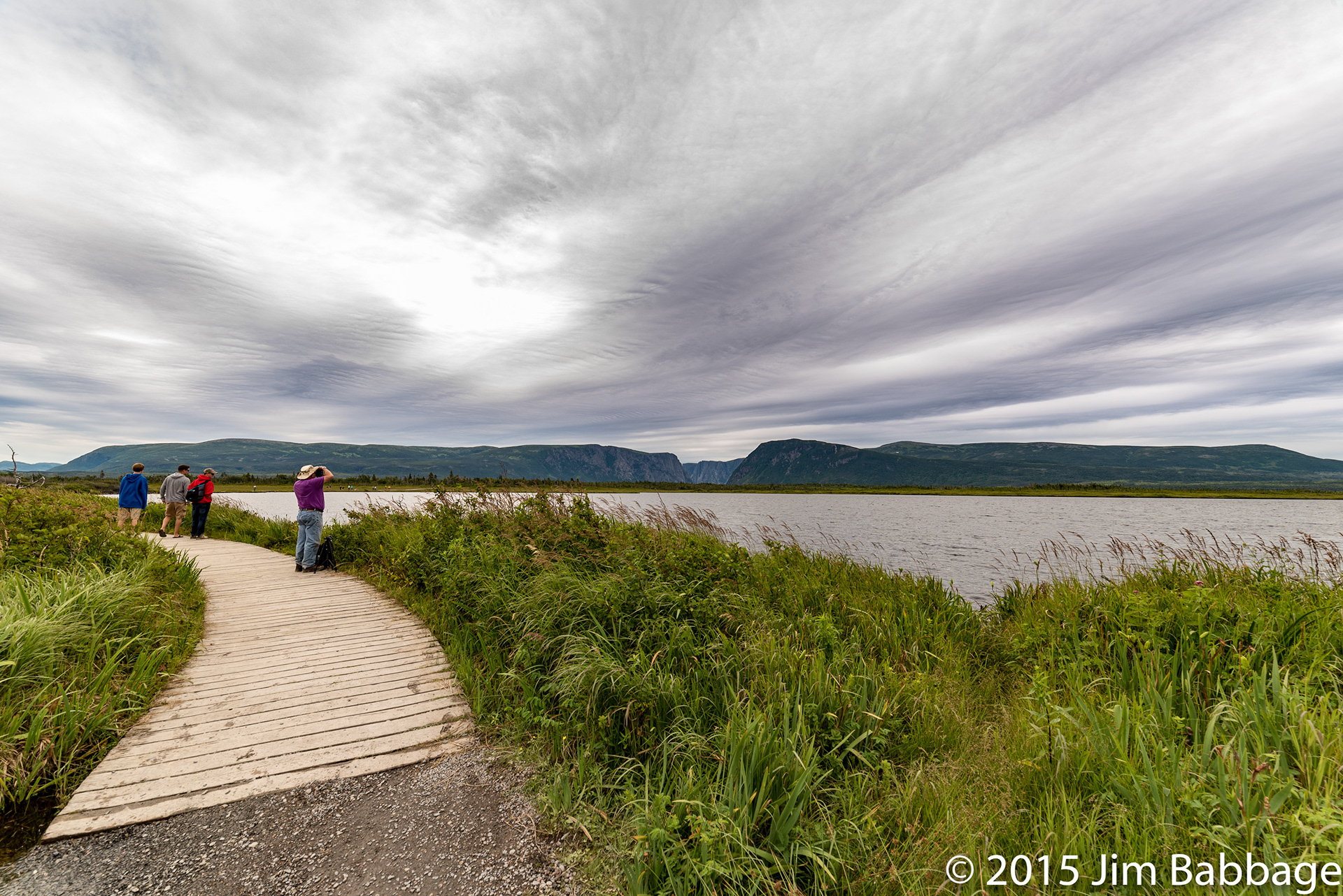
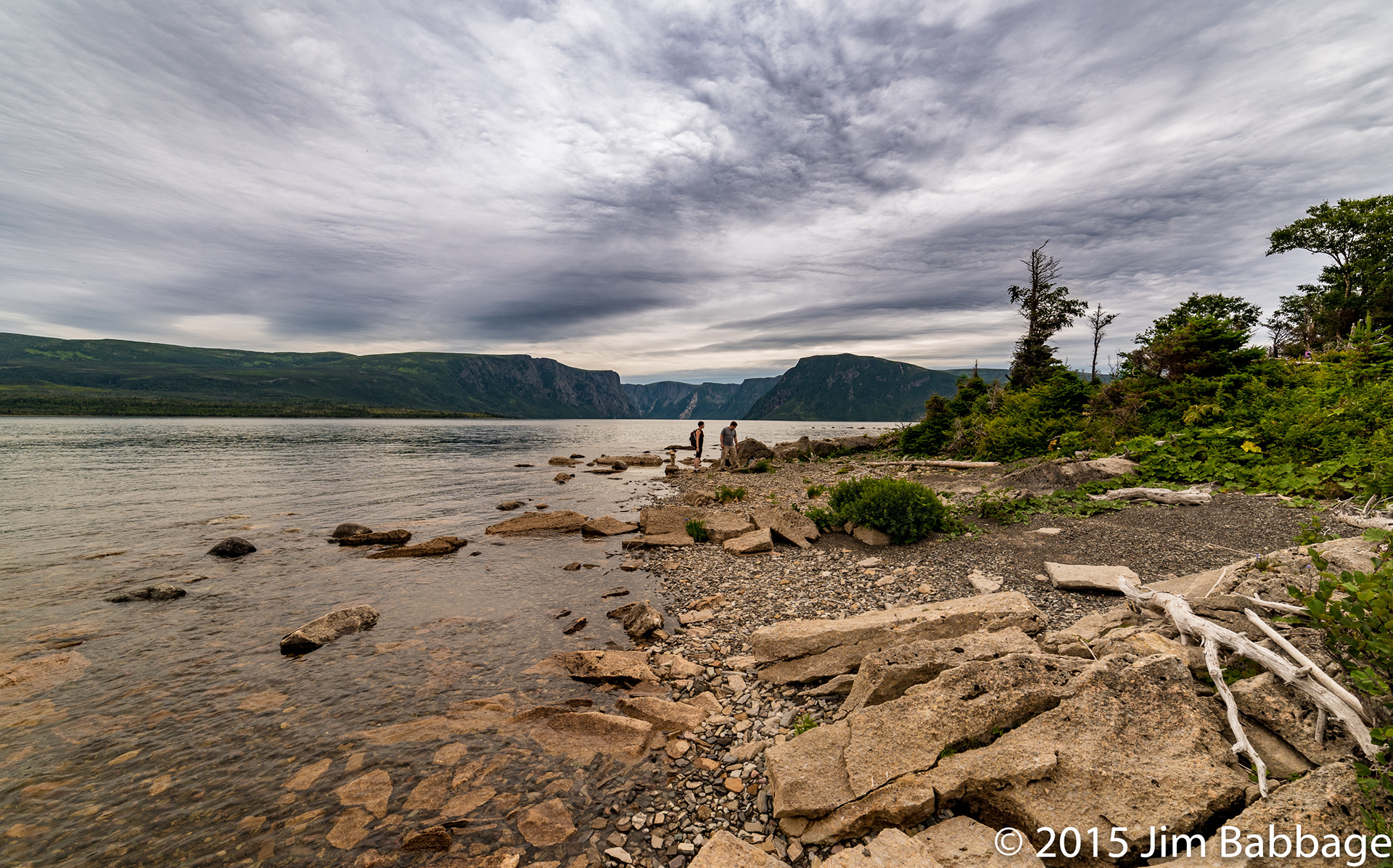
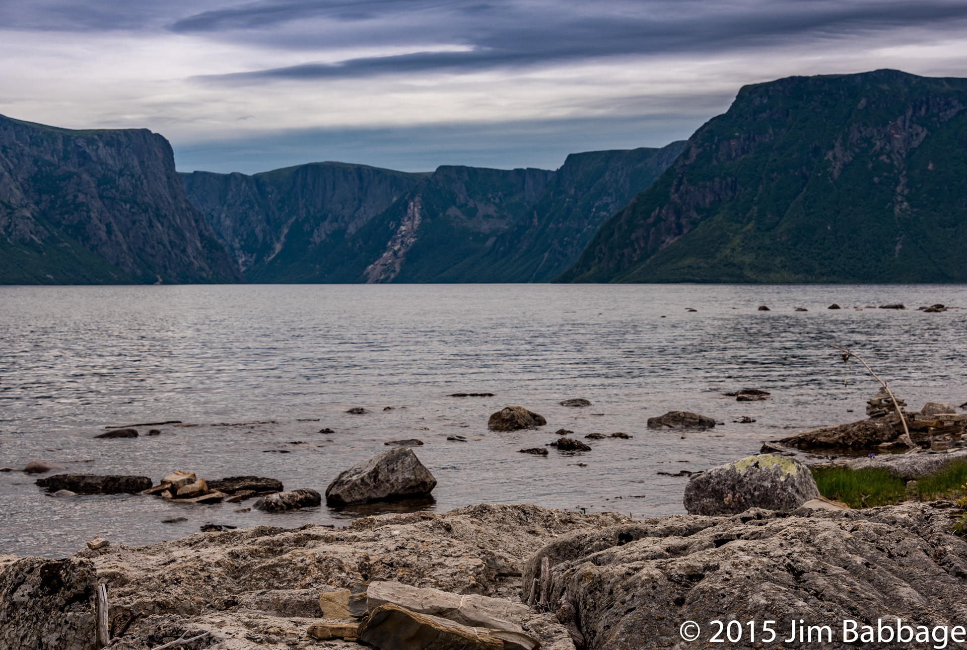
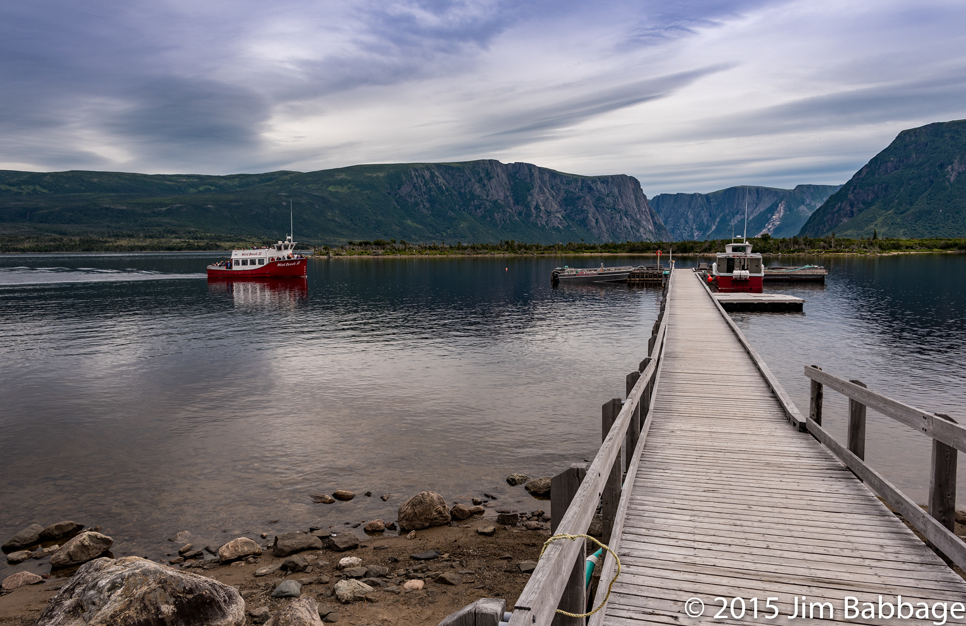
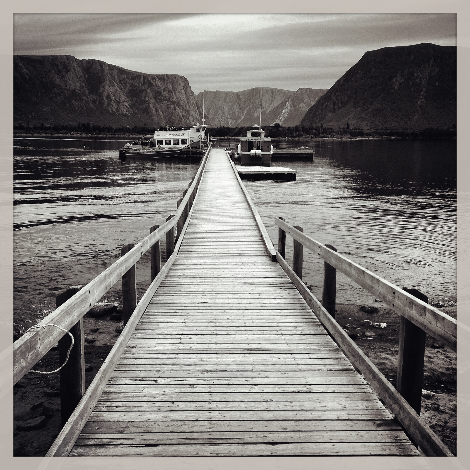
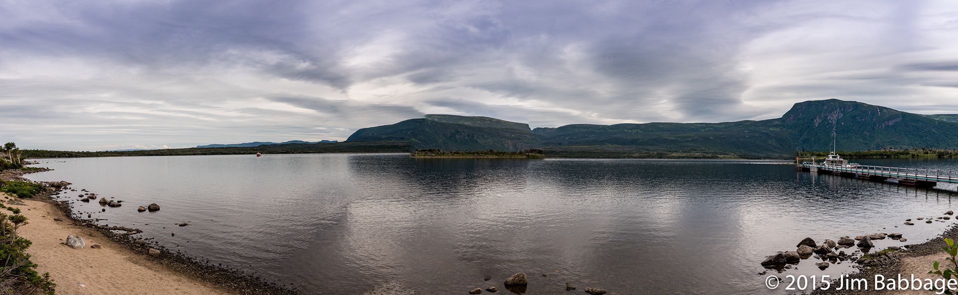
Western Brook Pond
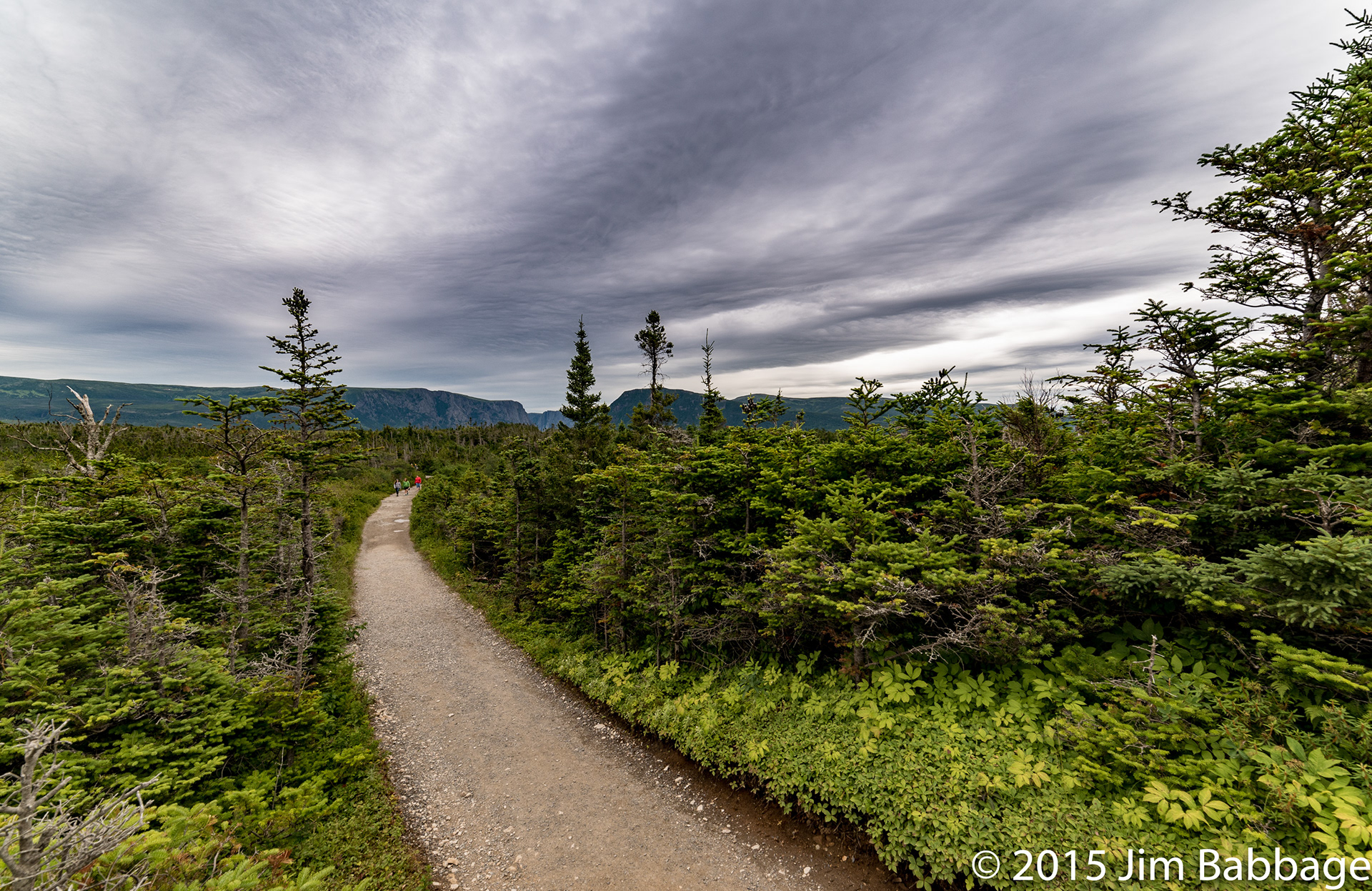
We had been assured that this hike was a much easier one, compared to Green Gardens. Regardless, I was still hesitant until I saw elderly couples and pregnant women returning from the looped trail. The sights, though, did not disappoint in the least, despite the overcast day.
Technote: If you ever want to win an argument over why shooting RAW is a good idea, pull up almost any image that includes a lot of overcast sky, then show the original image and the final. In every one of these grey sky shots, the sky was basically a light grey with no detail until I process the image.
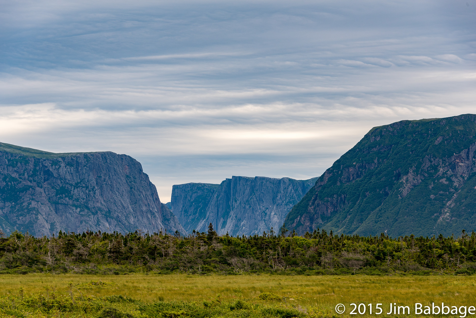
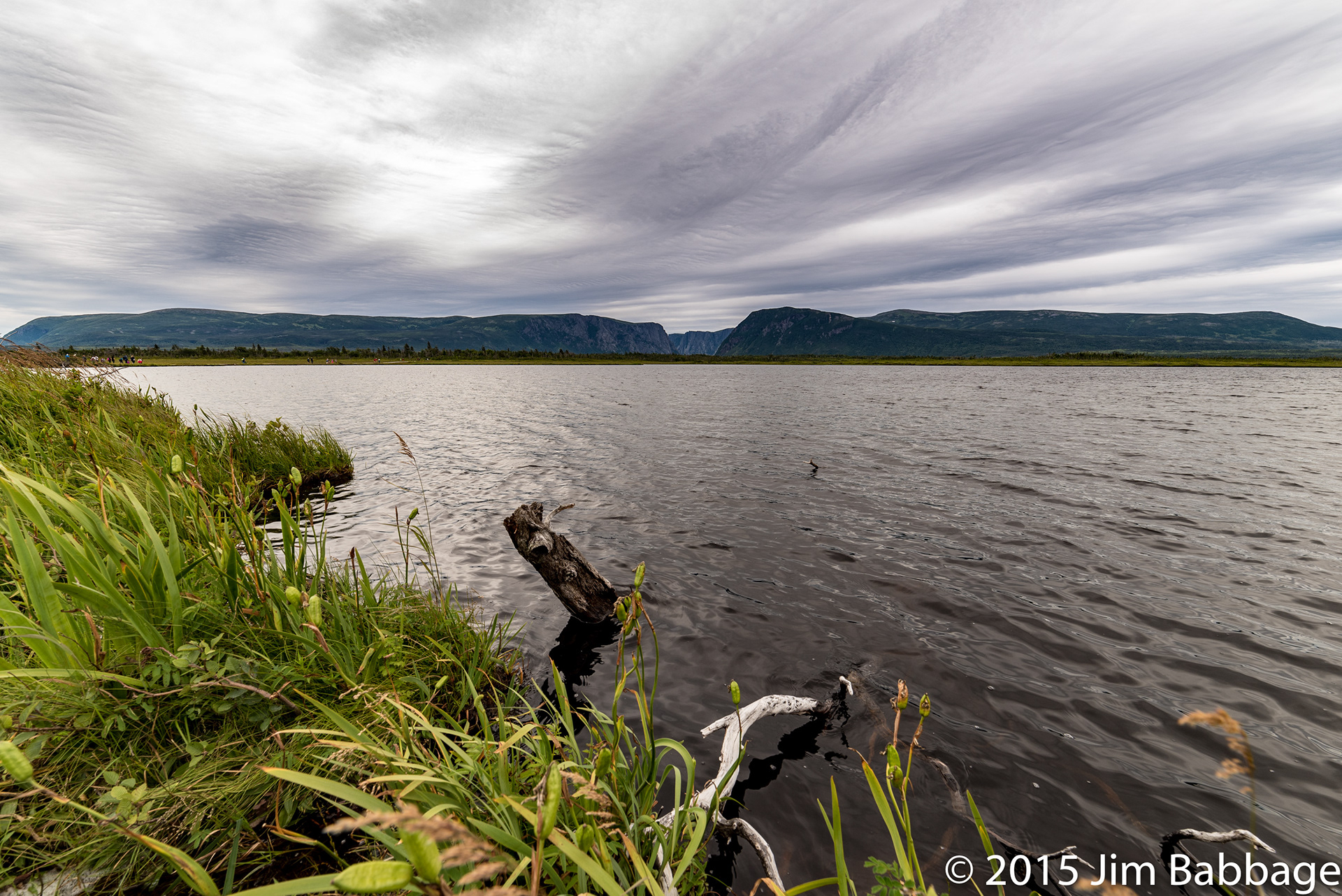
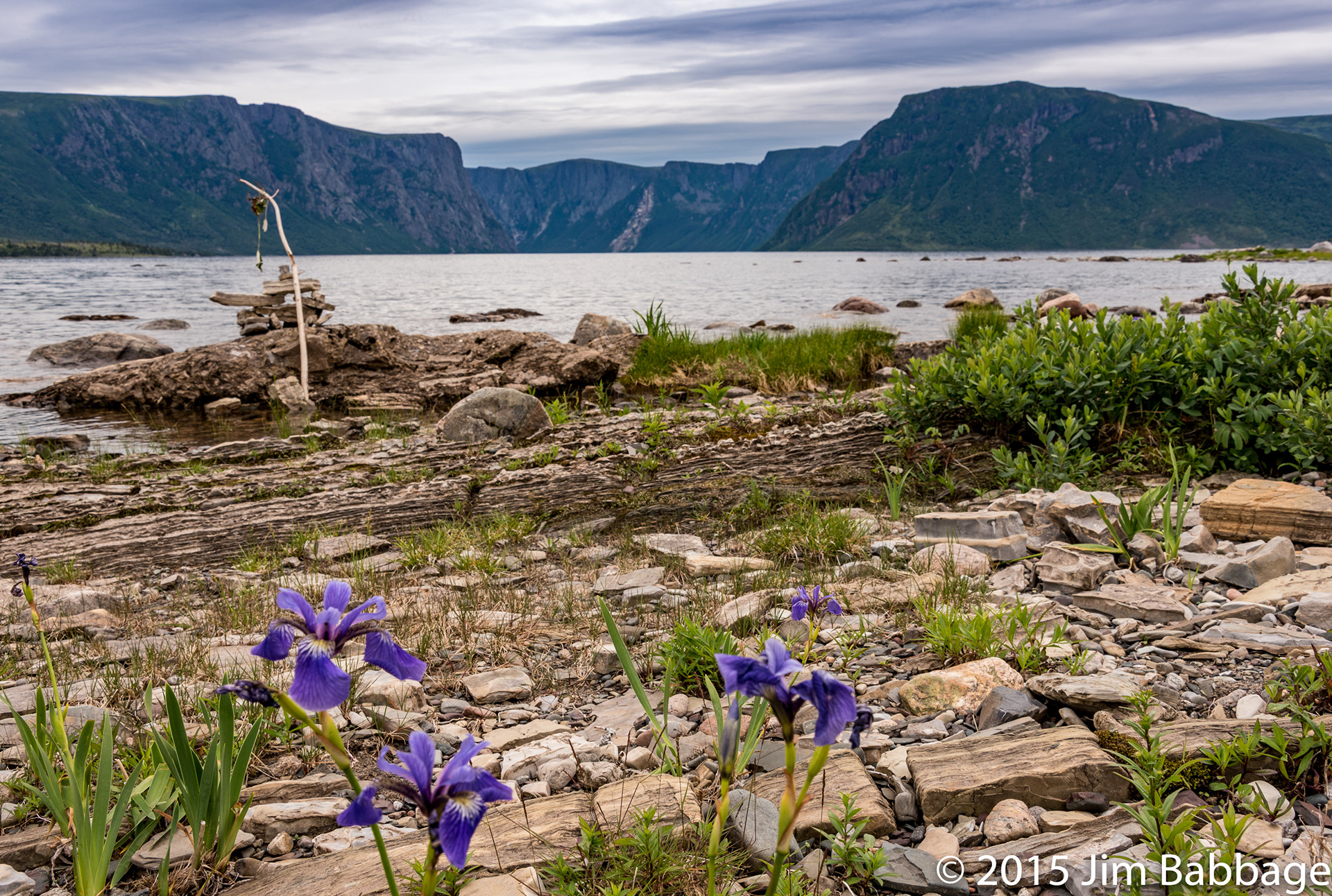
The magnificent cliffs in the background (a backdrop to almost every photo in this set), are at the mouth of the Western Brook Pond Gorge, and rise 650 metres from the water.
I used my 14mm Rokinon quite a bit on this hike. It pulled at the corners sometimes (above) but overall was a very useful lens.
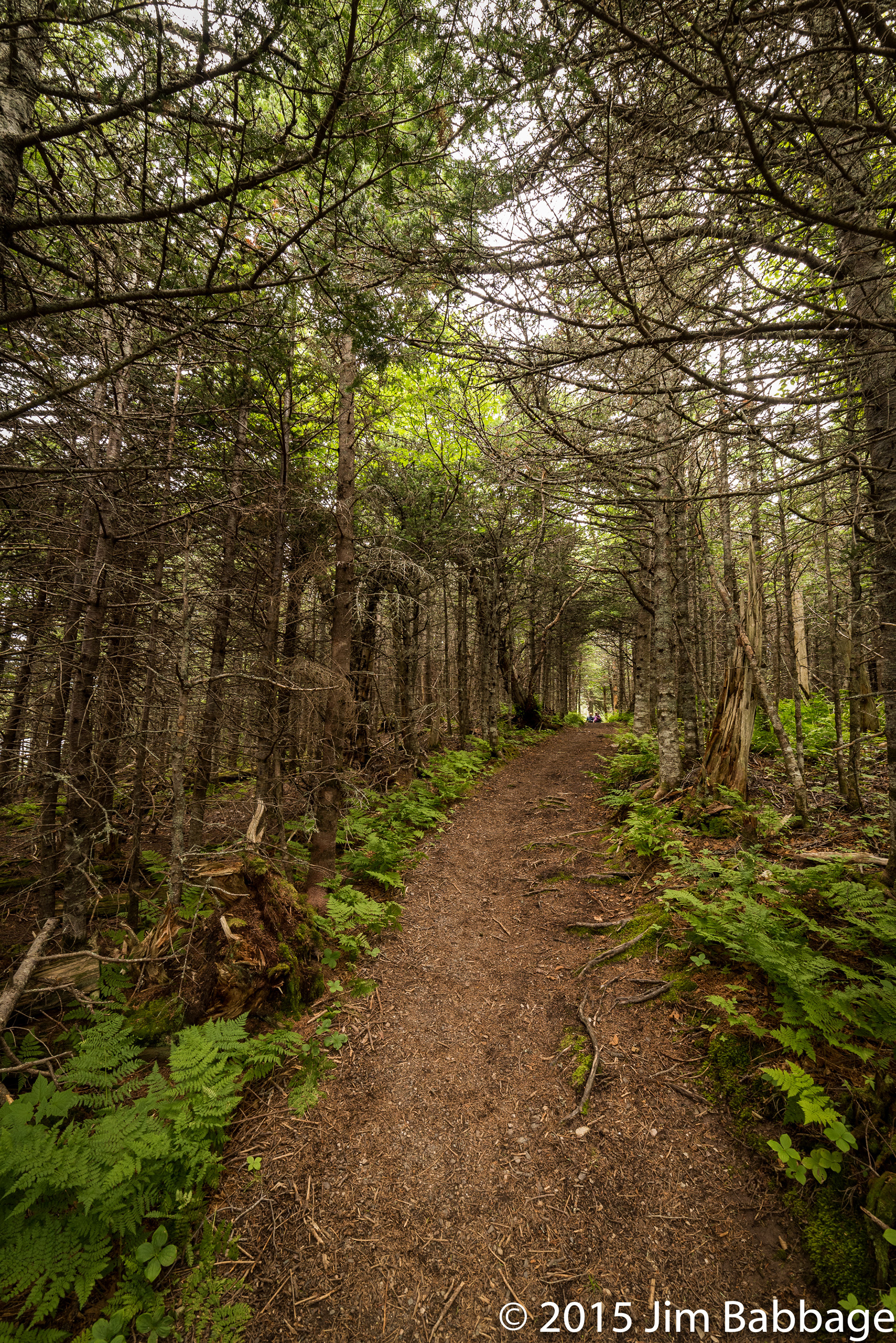
Snug Harbour Trail
There were a LOT of people on the main trail, so when we found an offshoot trail, that was only an extra kilometre, we took it. And I'm glad we did. It was more of a forest trail, narrow and often muddy, but it led out to the Western Brook and the shore of the pond itself. Rather than try crossing the brook to contnue on the trail (which appraently had spots where the mud was knee-high), we stopped at this point and took a photo break.
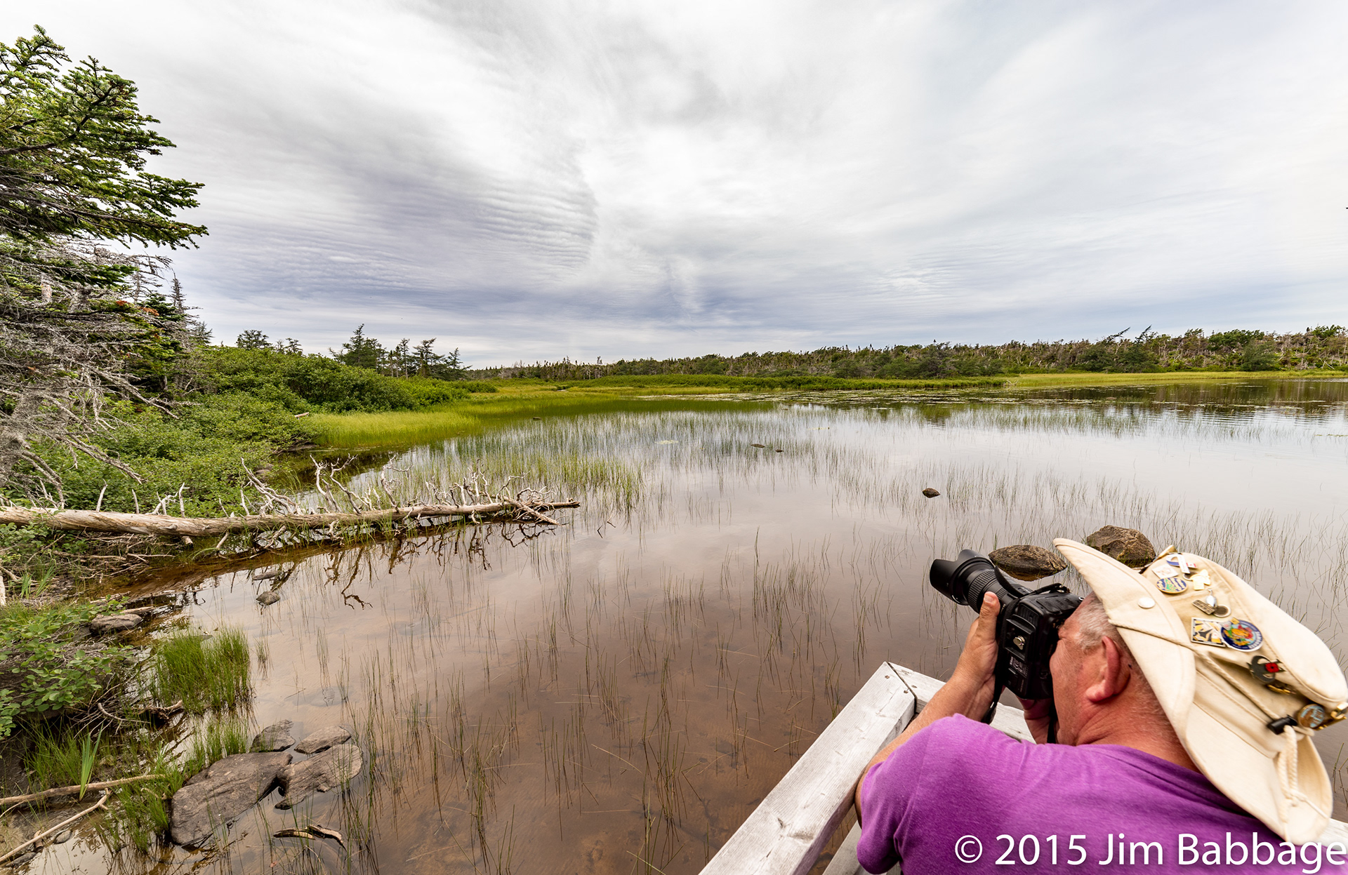
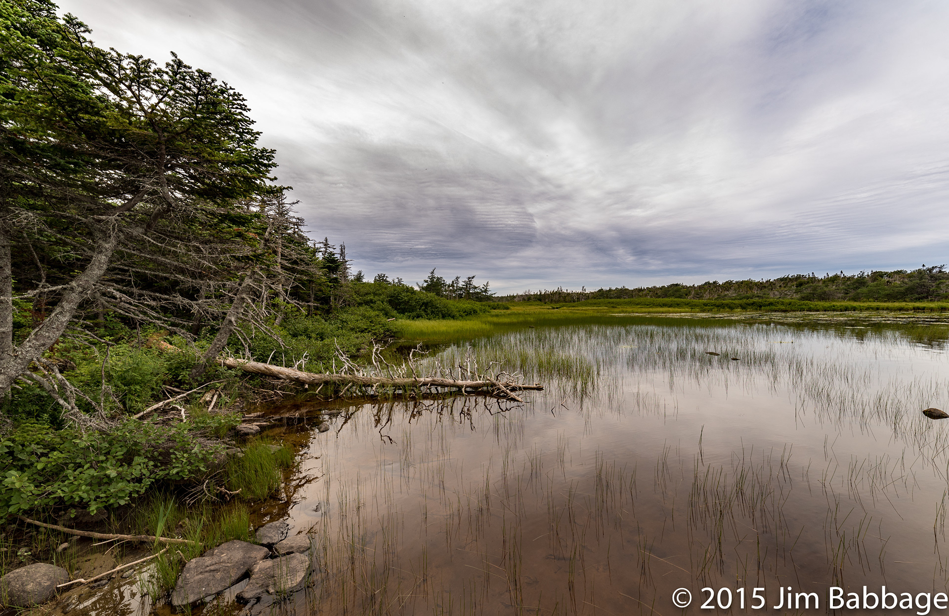
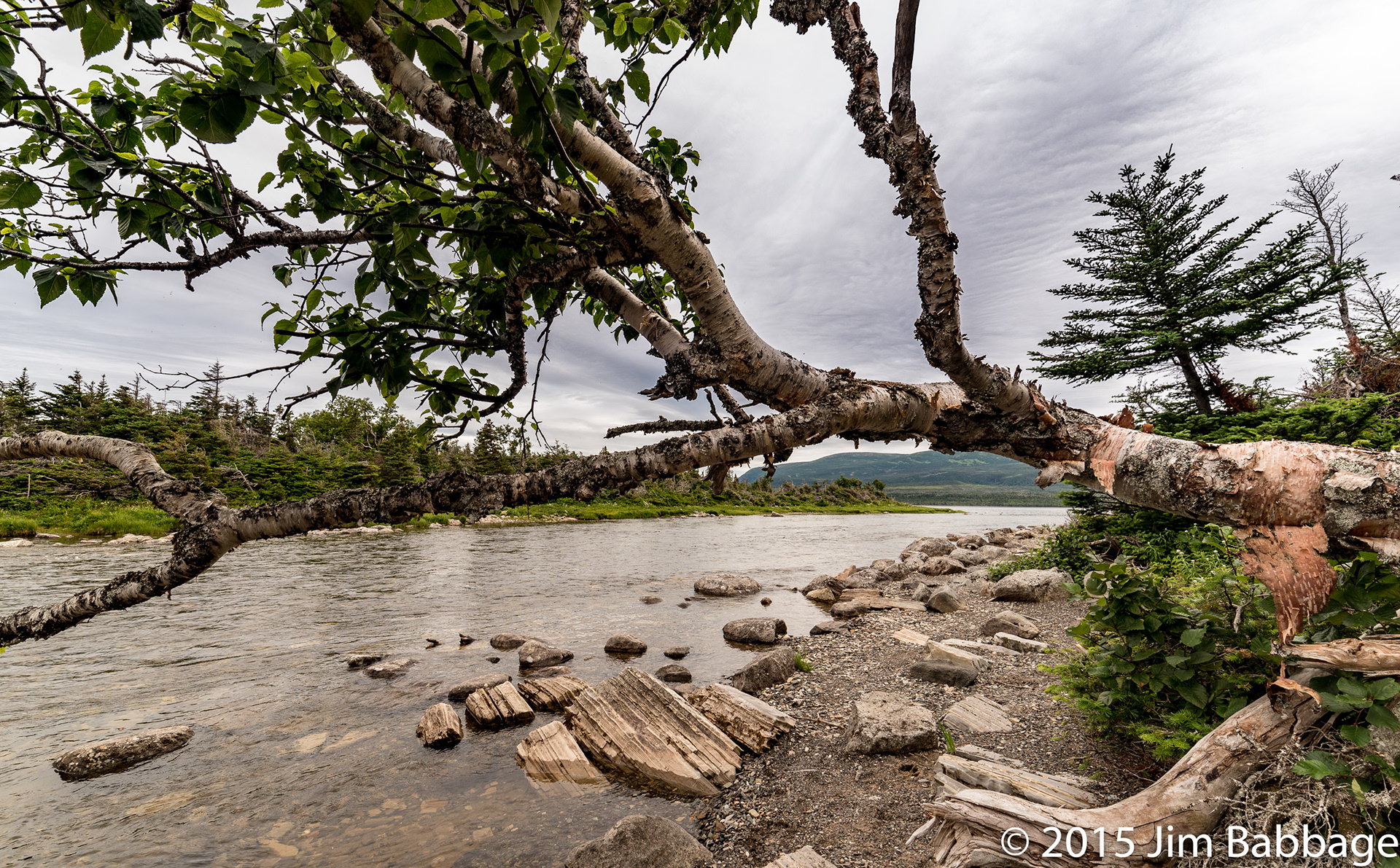
Western Brook. This is where we stopped, rested and took photos before continuing on the the boat docks at the shore of the pond.
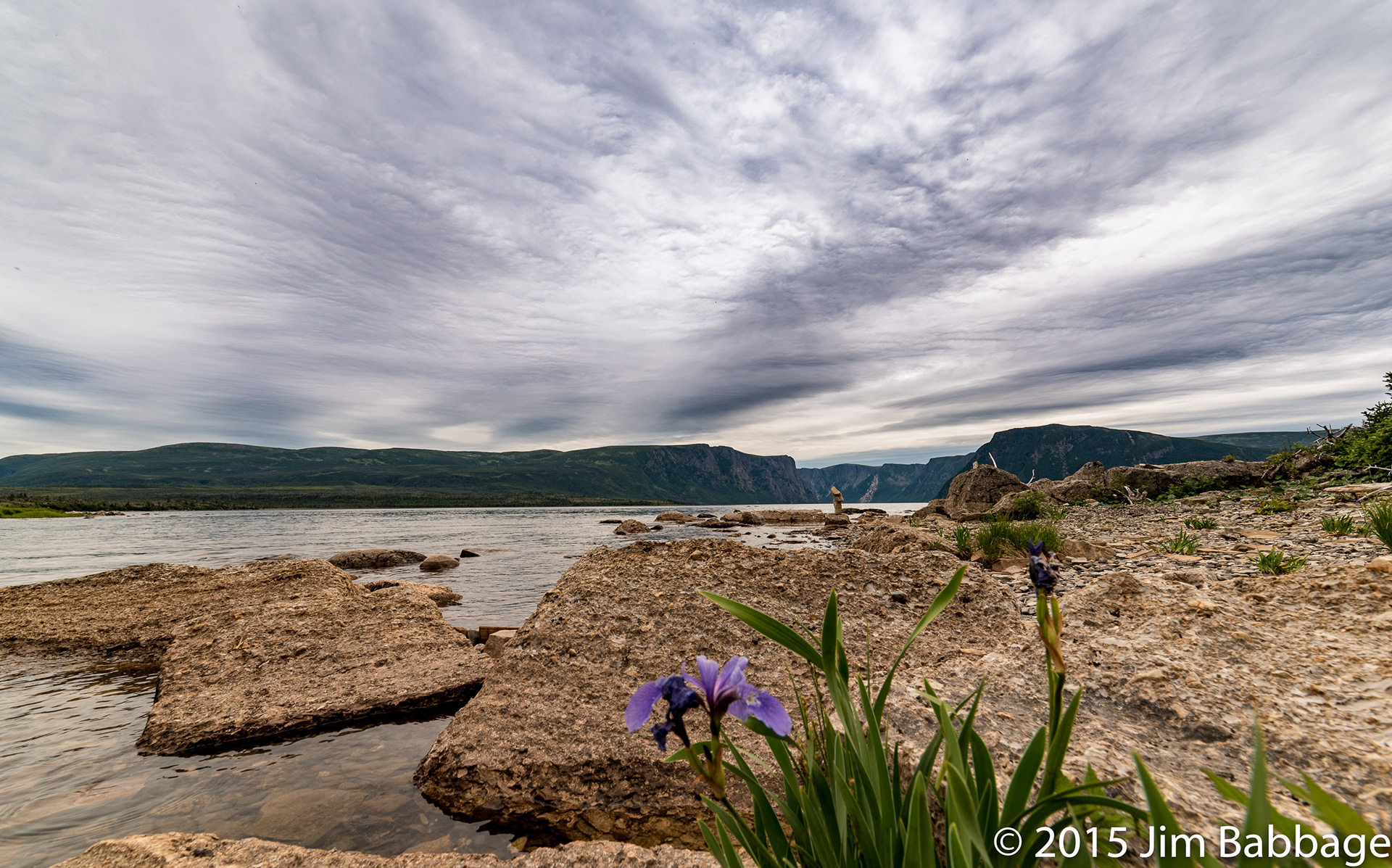
Wild, indigenous irises grew all over this shoreline and many other places we hiked. It was just so odd, seeing them poking out of the rocks, but they did add a nice splash of colour.
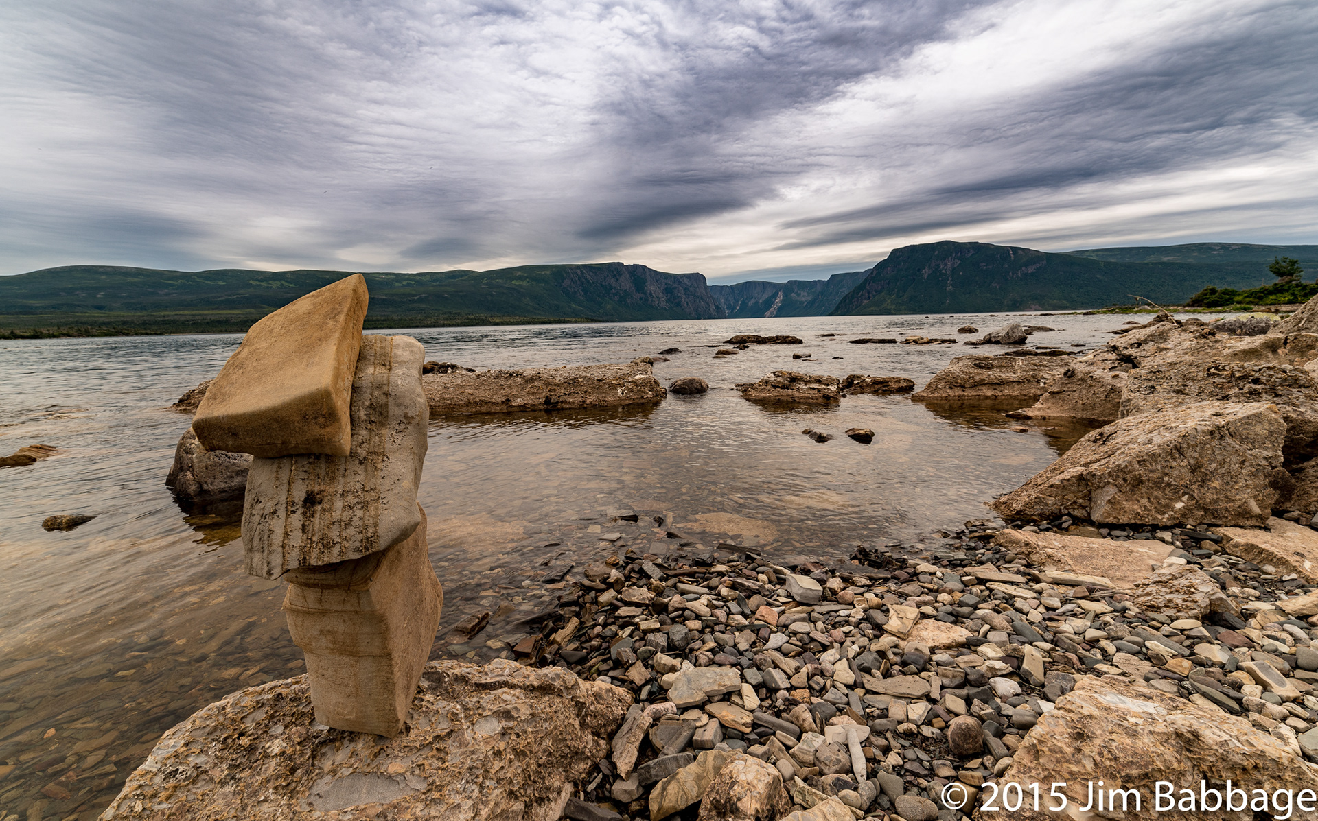
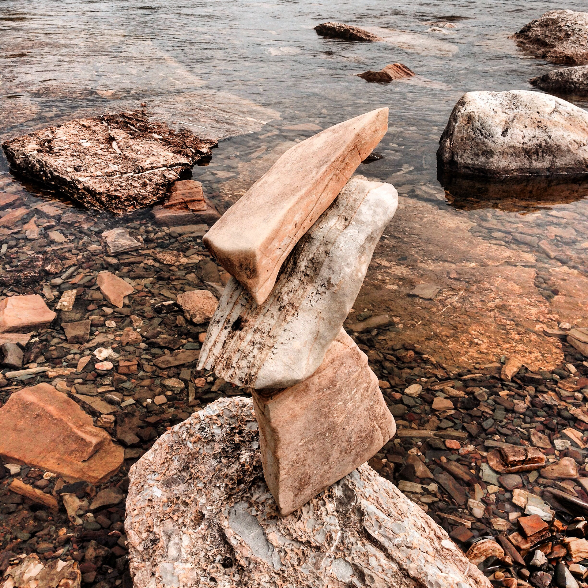
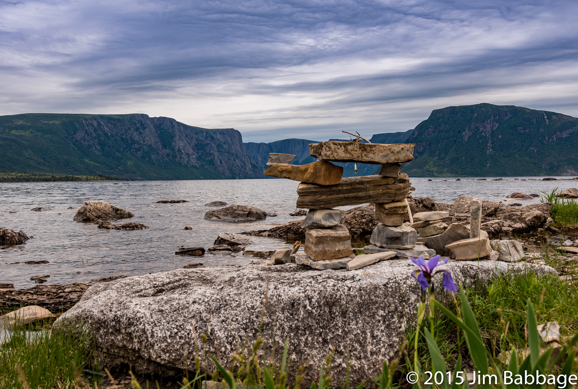
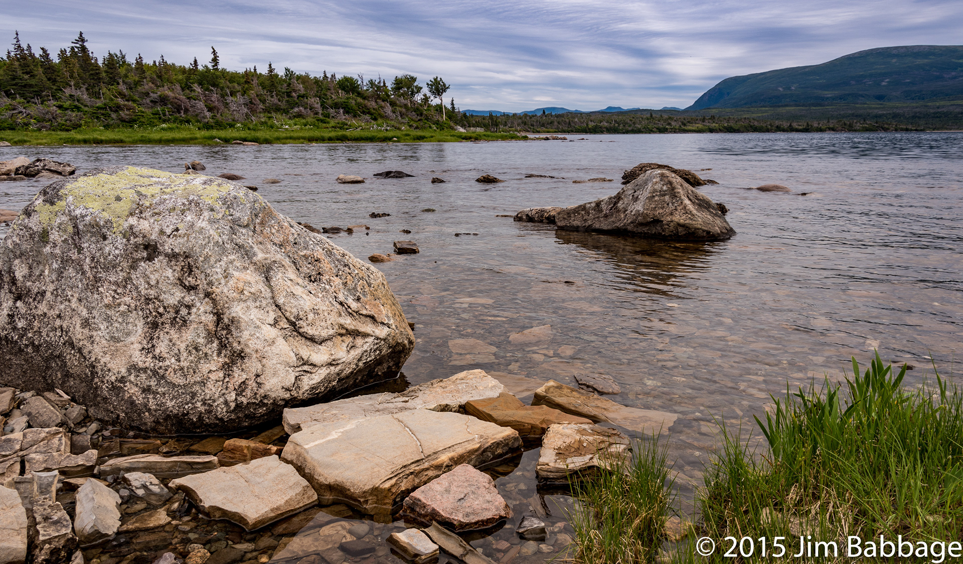
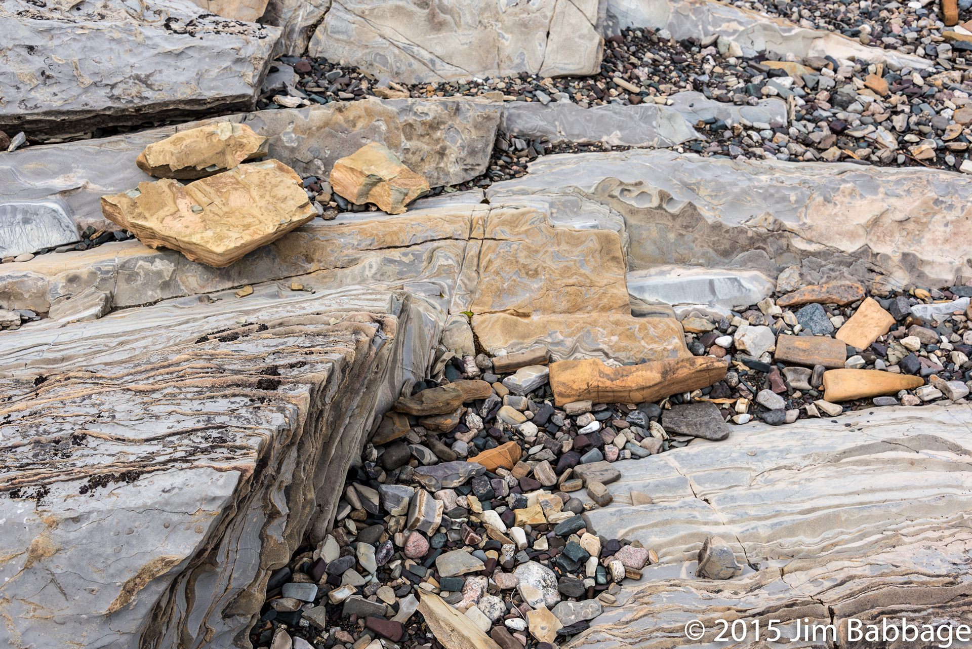
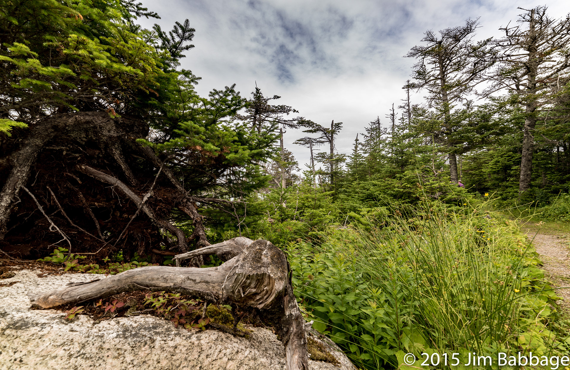
The sedimentary rock that made up the shoreline, also made for some great compositions (and a couple souveniers).
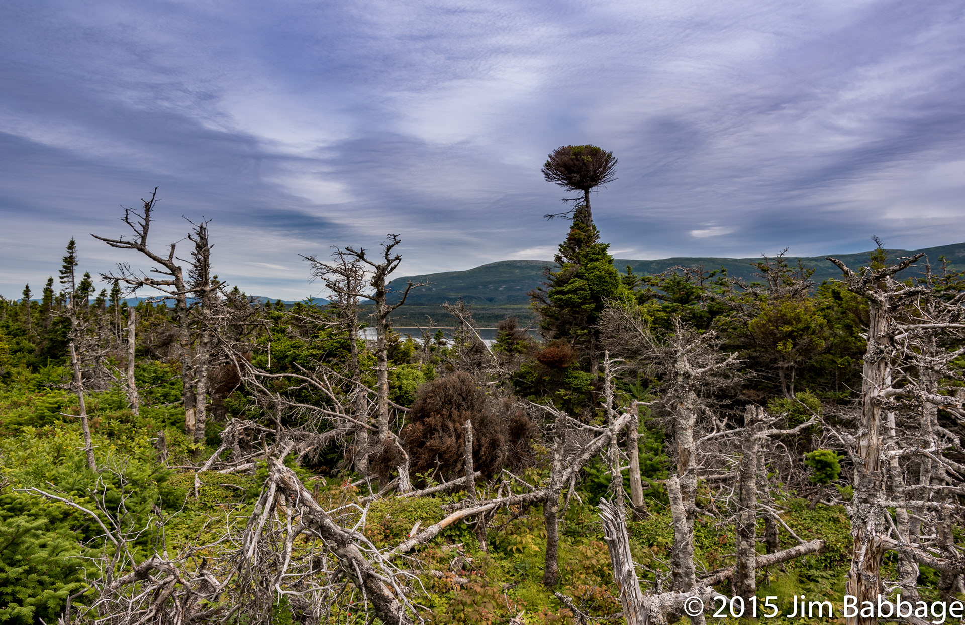
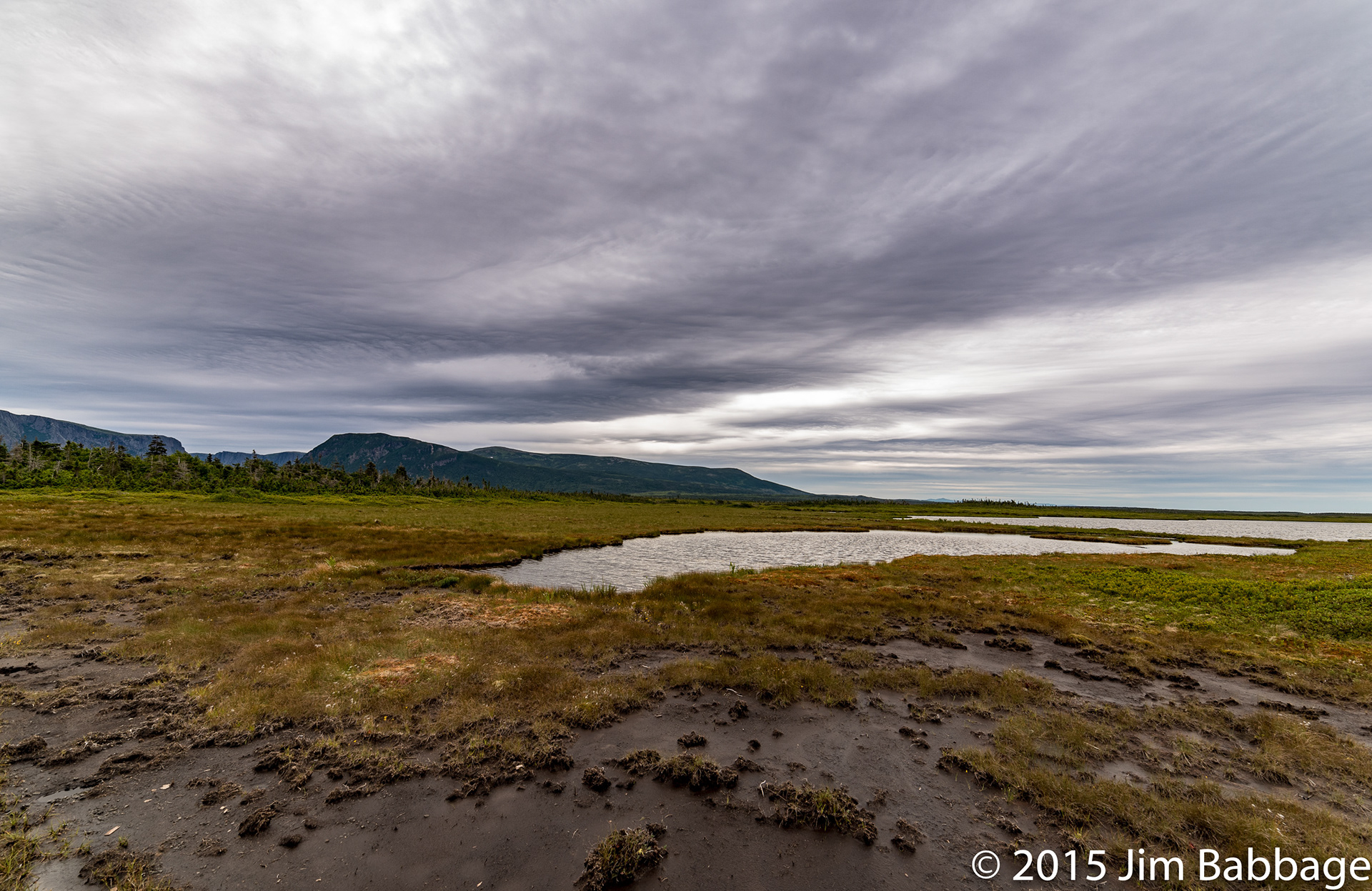
The terrain and landscape was a combination of rich green, windswept pines and dead, stunted forest. The bog that surrounds much of the trail is doing its job.
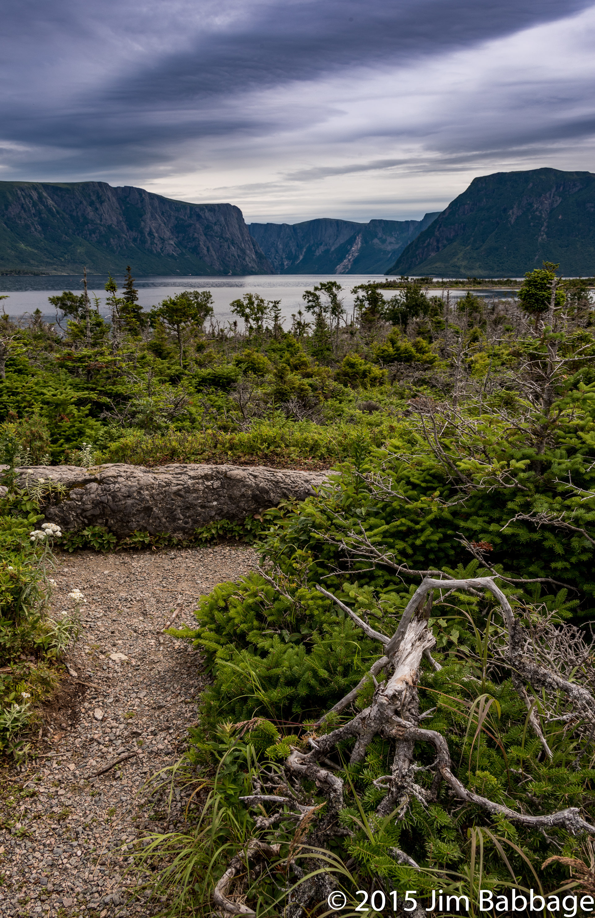
I read that the winds coming through the gorge can race as high as 100km/hr, which easily explains the odd shapes of many of the fir trees.
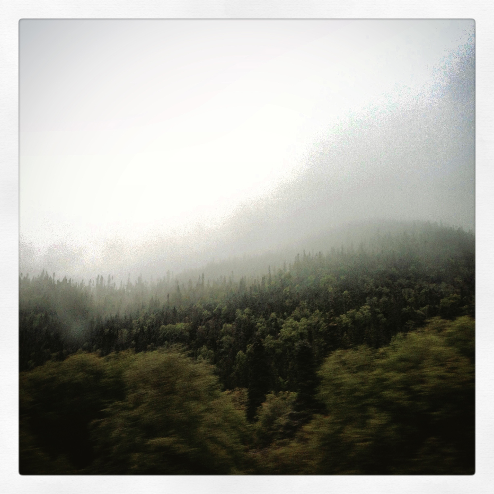
Our excursions were cut short soon after we made it back to the vehicle, thanks to more rain. We grabbed some lunch in Sally's Cove (where I almost ordered Moose soup), and headed back to Woody Point. The rain was so heavy that we did not even stop for quick grab shots, although the odd shot from the moving car was still an option.
This was our last day at Woody Point and Gros Morne, and even though the time was short, we gained a great appreciation for the land and the people that call this marvelous, terrible place, home.
I hope you've enjoyed this series (it would seem many have, based on the comments), and that these projects have piqued your interest in visiting Newfoundland or even just exploring your own locale with fresh eyes. Travel is great, but you don't need to travel to make great images.
You just need to see.