The annual Excellent Adventure has come to a close for 2015 and this year, the four of us (myself, my friends Tom Green and Doug Winnie and my son Joseph Hutt) went where none of us had gone before; the Rock. It was a great week. We saw many amazing things in Gros Morne National Park and Woody Point where we stayed, and got a good dose of culture and history in St John's (All four of us became Honorary Newfoundlanders at a Screech-In on George Street in St. John's).
I have culled nearly 560 photos down to about 160. That series went on Flickr last night. This series is culled further, but it's still large enough that I've decided to break it up into parts (a technique I'm stealing from fellow Behancer - David Martin.
Part 1 was the beginning of the adventure, so you will see photos from Pouch Cove.
Part 2 includes photos from Witless Bay, Colony of Avalon.
Part 3 covers St John's, Cape Spear and Signal Hill.
Part 4 will be the first two full days at Woody Point (Sunday night to Monday night).
Part 5 encompasses the Hike from Hell.
Part 2 includes photos from Witless Bay, Colony of Avalon.
Part 3 covers St John's, Cape Spear and Signal Hill.
Part 4 will be the first two full days at Woody Point (Sunday night to Monday night).
Part 5 encompasses the Hike from Hell.
Part 6 focuses on a much nicer hike to West Brook Pond.
The Green Gardens Trail - AKA The Hike from Hell
Or so it was for 3 of us, two of whom aren't in the best of shape, and one suffering from an overdose of Screech. When we spoke to the staffer at the Woody Point Discovery Centre, we were told - fairly accurately - that this trail wasn't too difficult if we stopped at the Green Gardens observation area. The trail then split off to a route down to the shore. It was described to us as "moderate" in difficulty. I think 3 of us, all over 40, would argue that rating.
The path to the shore was relatively steep, with many man-made wooden "steps" of inconsistent depth. After about 45 minutes, we were still 30 minutes away from the shore view, and realized the return route - all uphill - was not going to be easy, or fun.
So, we caved in and after a short break, started heading back up the steep incline.
It took a looooong time, with many rest breaks. My son volunteered to go back to the car and bring back more water - something we had under-estimated a need for.
So what you see here are mostly images from the first part of the hike. By the time we hit the steps, I had packed my camera to make the downward (and upward) trip a little easier.
By the time we made it back to the Green Gardens observation deck, I think we were beyond exhausted.
A small side story:
As we were approaching the top of the trail on our return, we passed a middle aged couple making the first part of the descent. 15 minutes after we had collapsed on the observation deck, they reappeared. The man said that one look at our faces gave him second thoughts about proceeding any further.
Thankfully, they shared some water with us before they took their leave. Later on the trail, they ran into my son, who was coming back with more water, and they informed him (much to his relief) that we had made it back to the observation deck.
At any moment, I expected to see Captain James T. Kirk somersault into view as he battled a fearsome reptilian being...

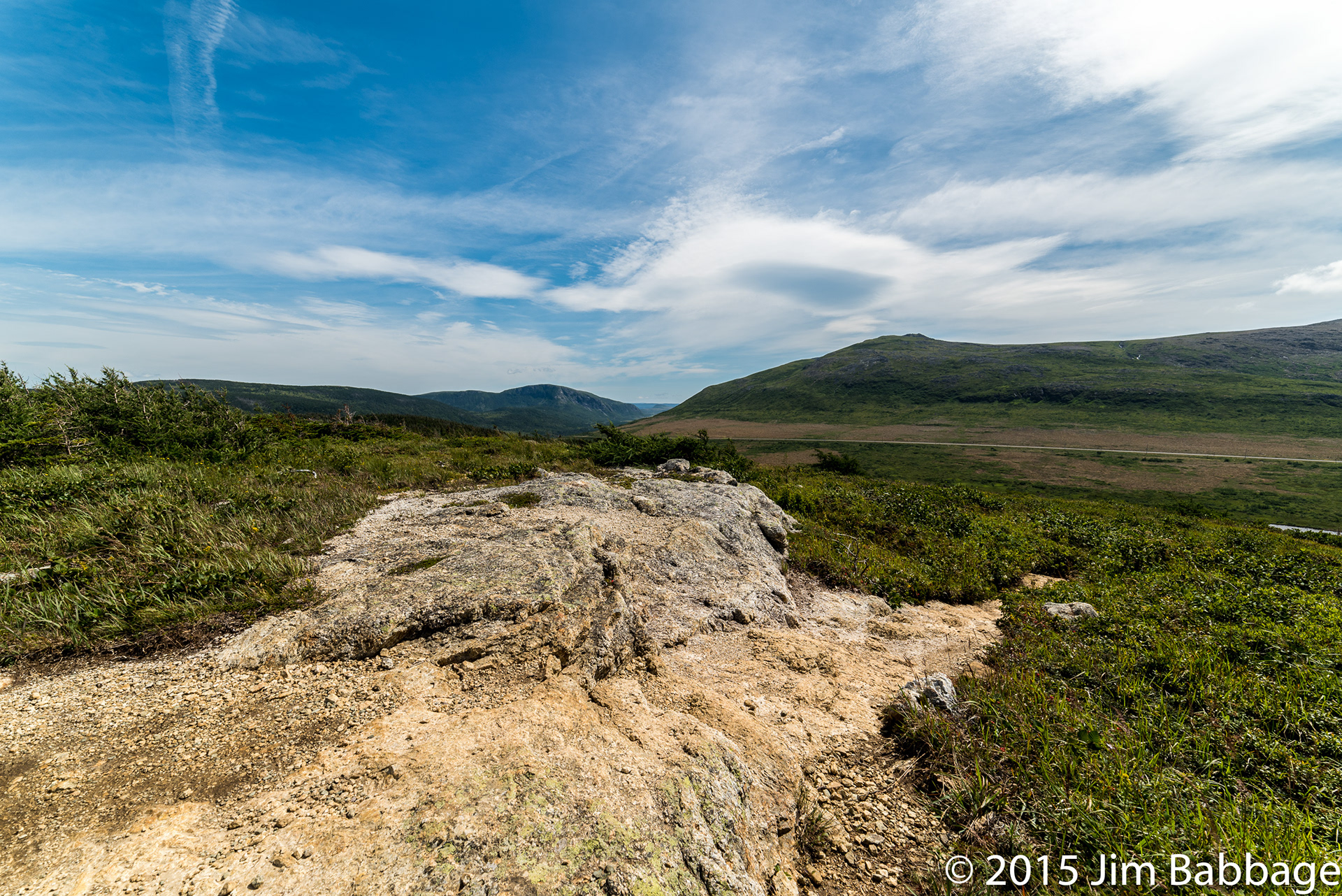
Into the unknown
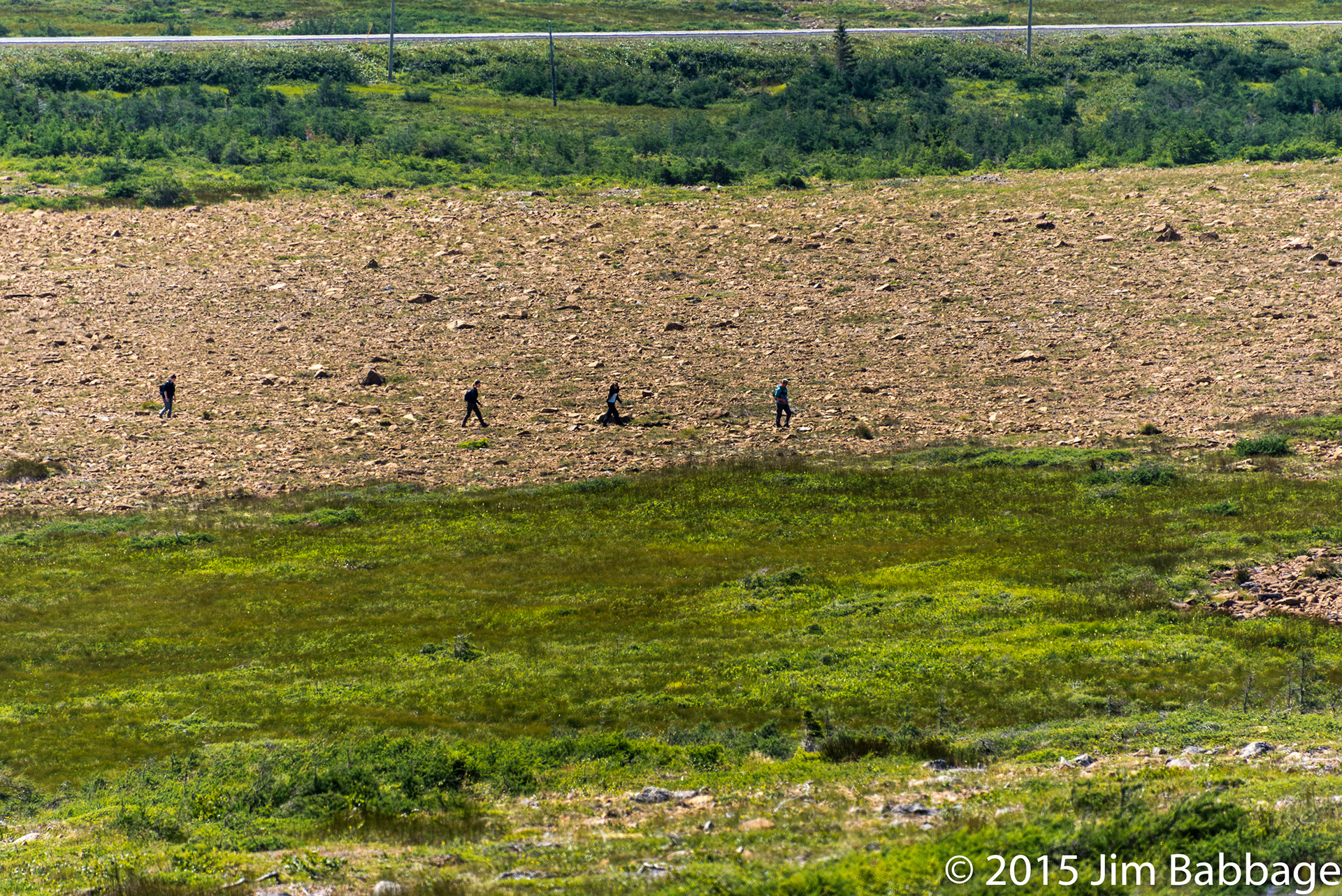
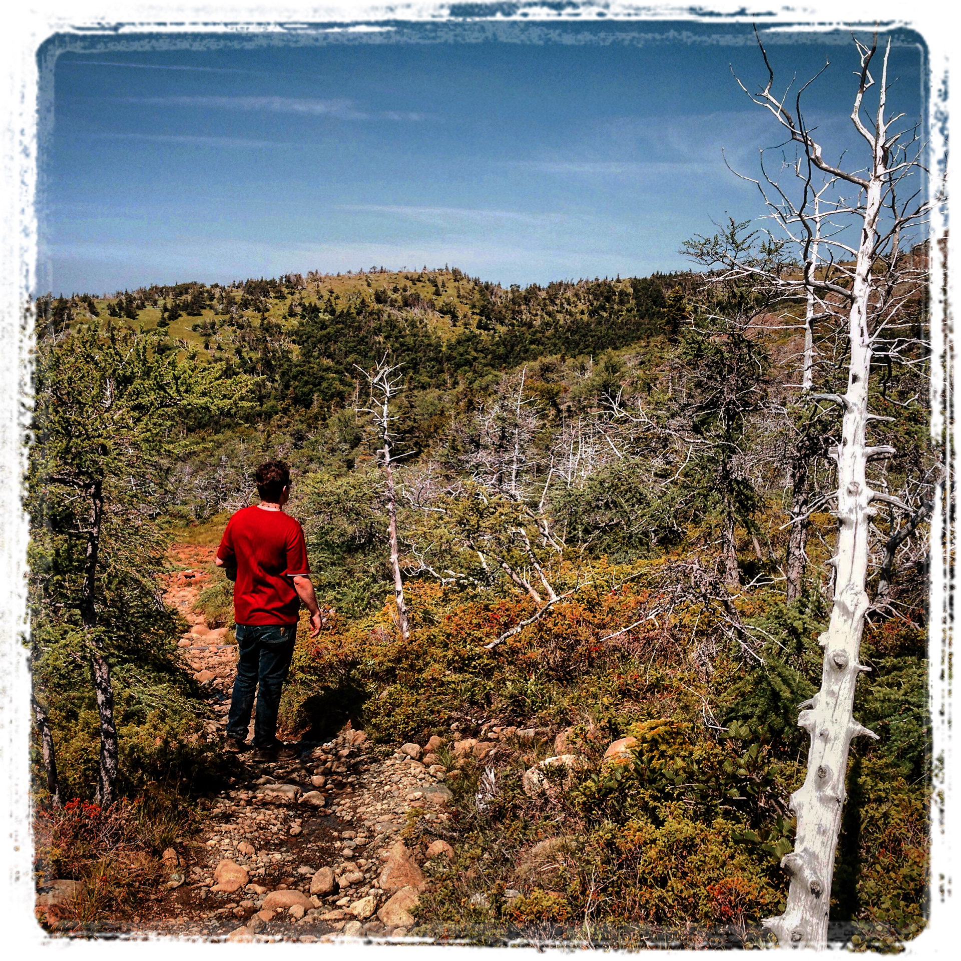
The trail we followed looked like a dry creek bed of polished river rock. Indeed, in many places, other small streams ran through the "path" on their way further downhill to the pond by the roadway.
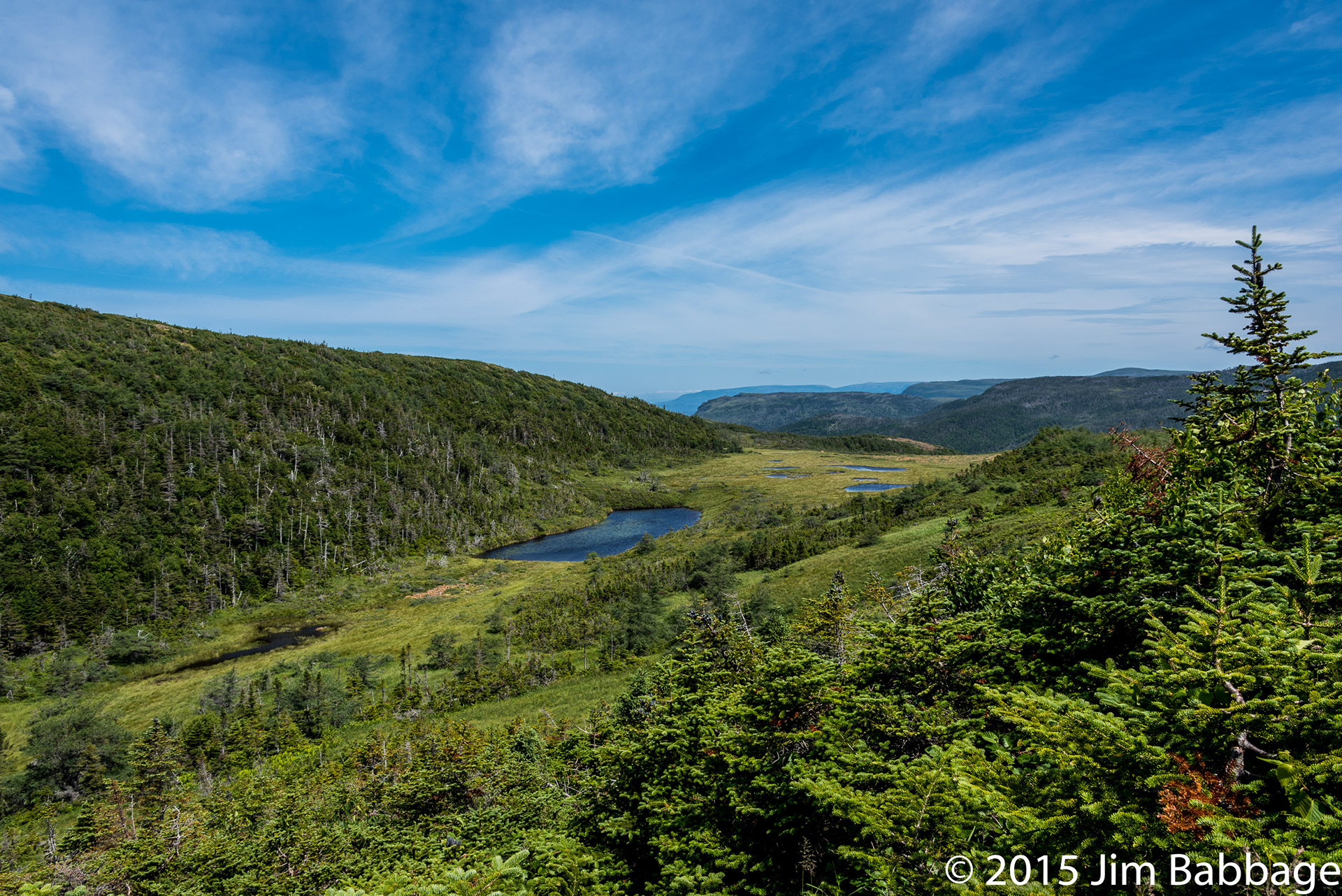
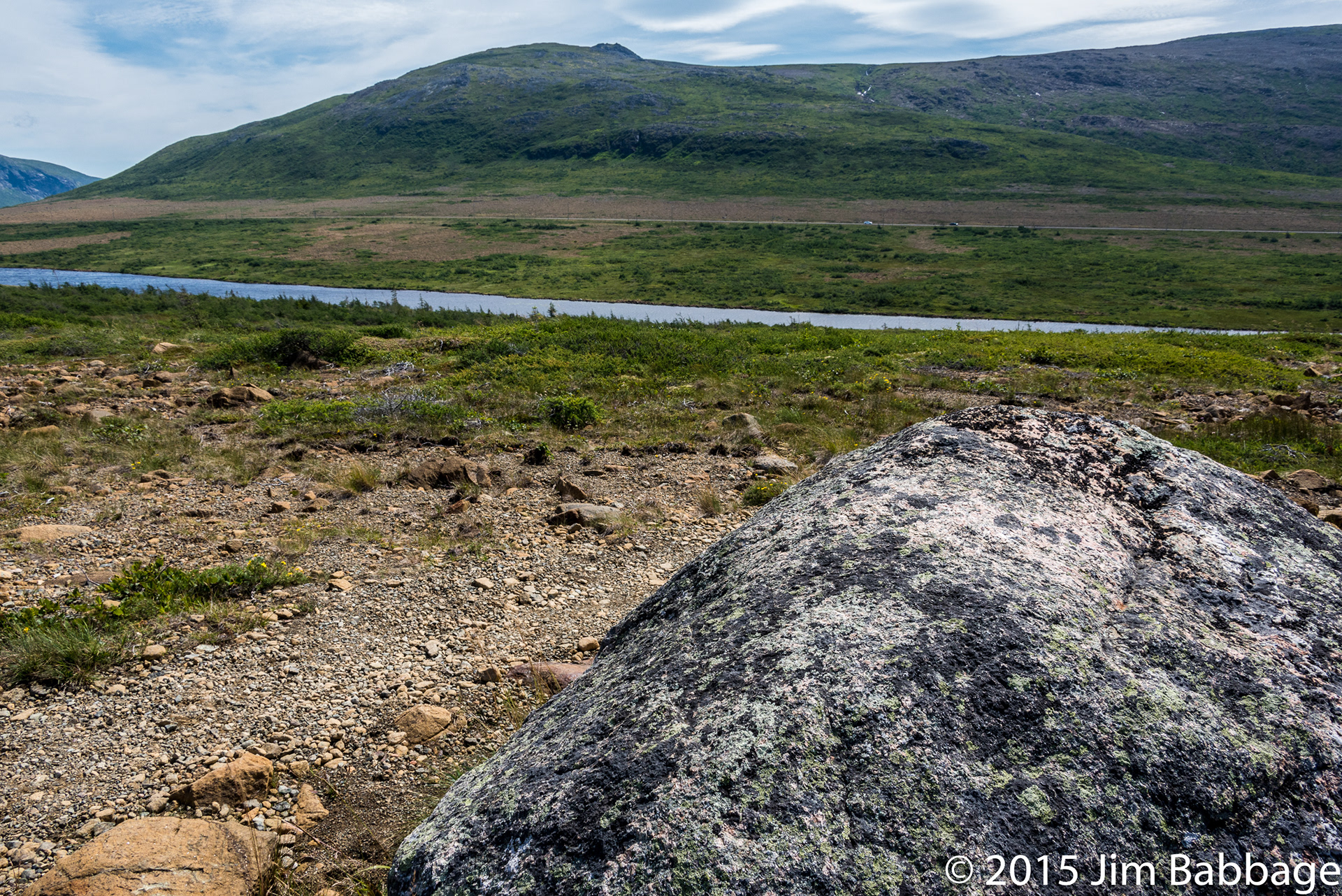
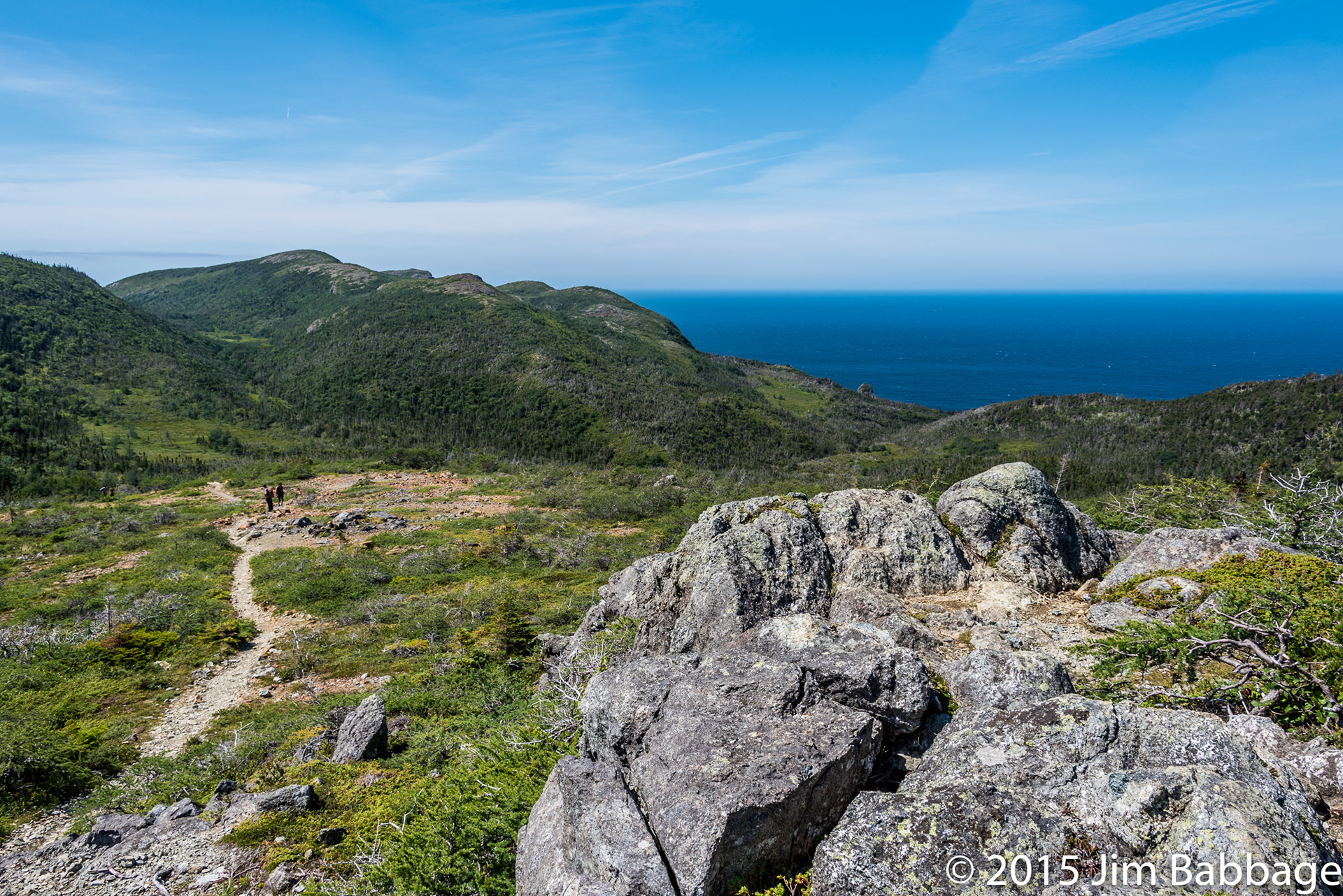
The endpoint for the Green Gardens trail was a wooden observation deck, overlooking a rich green valley. This is where we should have stopped.
But no, we opted to travel further, taking the trail that would eventually lead to our doom - err, the coast.
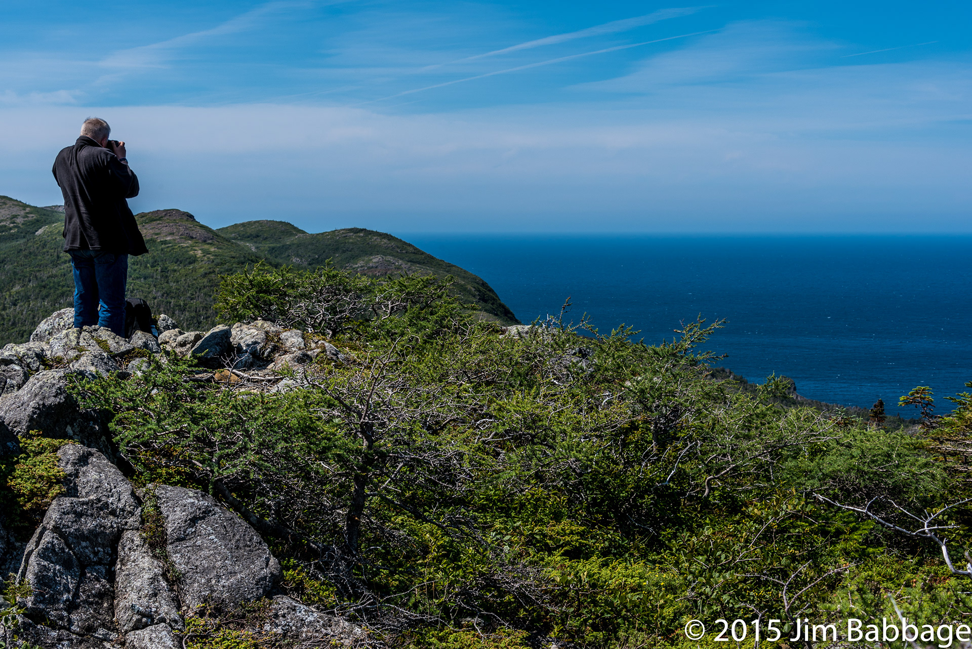
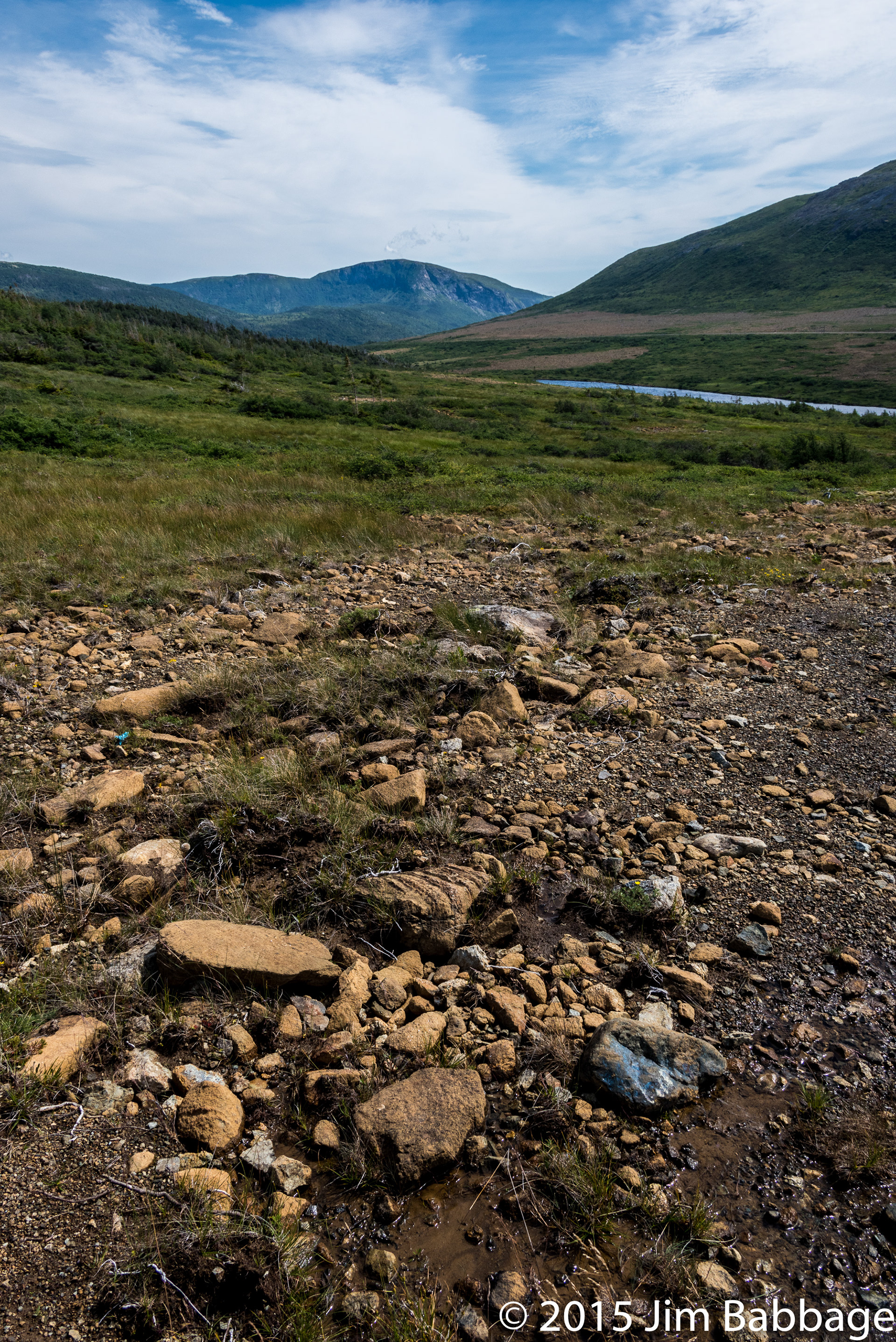
Our next rest spot was 20 minutes along the trail and really needed a sign stating, "Adandon all hope, ye who are out of shape or tired." Nonetheless, it was a stunning view, and visual encouragement to move on.

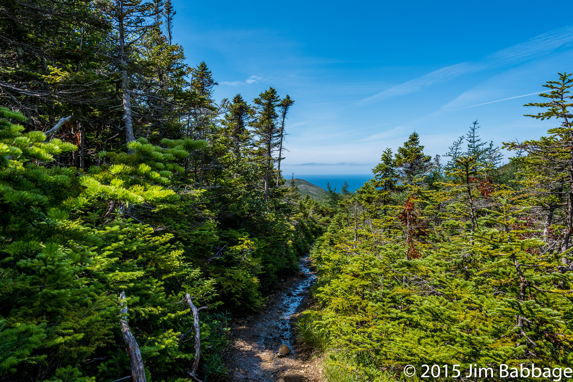
Follow the trail on the left. Where it disappears is the last piece of semi-level ground for at least 30 or more minutes. It's also where I packed up my camera.
Stranger in a strange land...